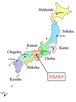
Osaka is located on Honshu Island. Osaka is located on the Osaka plain, which helps it in Japan’s economy. The Osaka plain is an ideal location for growing crops, also since Osaka is located next to the Seto Inland Sea it helps to protect the city from typhoons. Osaka Plain was originally a wetland, expanding to the lower areas of the Yodogawa and Yamato rivers. From about 300 B.C. to 300 A.D, the wetland was slowly changing into rice paddies. During the 1960s the area was quickly urbanizing, now only a few rice paddies are left. The Seto Inland Sea is an important trade route, that continues to be an important shipping pathway and is covered by large ferry networks.
One of the key physical features of Osaka is the Yodogawa River. The Yodogawa River and the adjacent flood plain offer an area for nature to flourish, and also for the pleasure of individuals. The Yodogawa River is also one of the 7 major rivers in Japan; it is supervised to guarantee that it meets the necessities of the large population.
Osaka, Japan has a fairly moderate climate. During the months of May, June, July, September and October, Osaka experiences enjoyable average temperature. On average, the warmest months are July and August. A lot of rain falls in the months of March, April, May, June, July, August, September and October. January is the average coolest month in Osaka, June is the average rainiest month, and December is the driest month. Throughout the winter months in Osaka, you can expect temperatures to remain around 50°F during the day, and slightly above freezing at night. The summer weather in Osaka has hotter temperatures, with of highs of 95°F and a fairly humid and warm climate. Most of the weather and temperate climate in Osaka is caused by its waterfront location, next to the Seto Inland Sea. Osaka’s climate patterns are somewhat similar to the ones we experience here in the valley.
Osaka may not be a very big area although; it has the second highest population density behind Tokyo. Osaka’s population is about 8.86 million people, with about 3.9 million households! The average land area of Osaka is about 1901km², which converts to about 733.98mi². Osaka may seem small, but it has a lot of people living there.
In Japan major agricultural products include grains, fruits, meat products, fishery products, and forestry products. Trade items include fish, prepared foods, cigarettes, and husked rice. The rice production in Japan met domestic needs, but production dropped from 13,435,000 tons (in 1995) to 11,468,800 tons (in 1999). Production of potatoes and wheat slightly improved during this time. Forests on the other hand, cover about 70% of Japan, of which 40% are man-made. Forestry products meet only a small portion of domestic needs (about 20% in 2000). The remainder of their forestry products has to be imported, mostly from the United States and Indonesia. Japan also has a large fishing industry. In 1999, about 2,924,000 tons of fishery products were imported, a rather large increase from the 1995 levels of about 2,803,000 tons. These are the three main types of agriculture that is used in Japan.


To the top left, there is an ariel image of the Yodogawa River in Osaka. The river stretches 47 miles (or 75 kilometers) across from Lake Biwa to the Osaka Bay. To the top right is another ariel image, but this is of the Seto Inland Sea, of which is located very close to the city of Osaka. To the bottom left, you will see a map showing where the Seto Inland Sea is located, and how close it is to Osaka. To the bottom right, you will see an absolutely beautiful image of the city of Osaka lit up at night.


